
Paradise Lost
Collapse of a Coral Reef Ecosystem of Bonaire
Published: September 29, 2025
This article is part of the Bonaire Climate Action series, highlighting individuals and organizations that support the Bonaire community's conservation efforts to improve their environment and address climate change challenges with resilience.


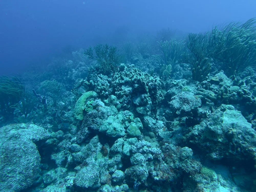
Both of these photos were taken in September 2025. On the left is the coral burren of Bari Reef, while the photo on the right shows a restored staghorn reef at Lac Bay, both located in Bonaire. Many of the shallow areas at the dive sites on the eastern coast are coral burrens. Since the 1980s, approximately 80% to 97% of staghorn and elkhorn coral populations have disappeared from Caribbean reefs. The collapse of the ecosystem has resulted from damage caused by hurricanes, coral disease, and marine heat waves. In the 1980s, Captain Don, who pioneered many of these sites, reported having to use axes to break through the corals in order to reach the deeper reef.
Where is Bonaire?
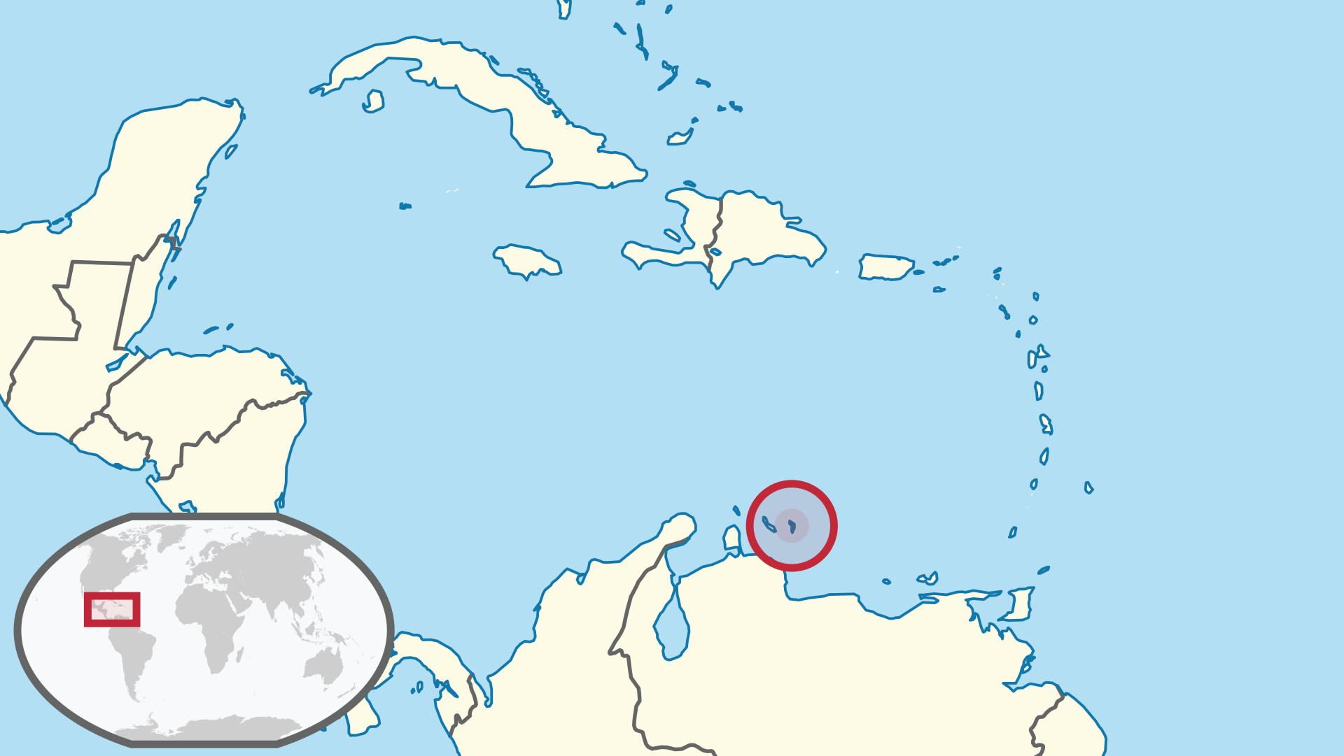
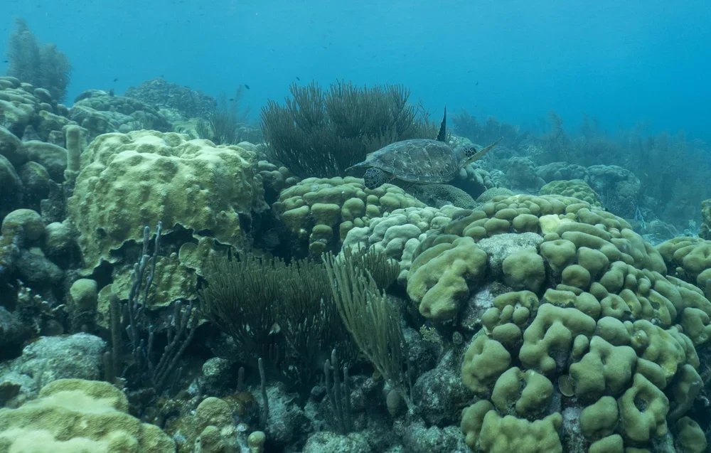
Kathy and I were excited to return to Bonaire, our 13th or 14th visit. We're not sure of the exact number, but we believe it's been at least ten trips. Bonaire is our favorite dive destination, known for its plentiful shore dives on some of the Caribbean's healthiest reefs. The ABC Islands—Aruba, Bonaire, and Curacao—lie outside the hurricane belt, often avoiding storms that stay further north. The Bonaire National Marine Park (BNMP), created in 1979, is one of the oldest and most successful marine protected areas, safeguarding reefs, seagrass beds, and mangroves around Bonaire and Klein Bonaire. The park hosts over 50 types of stony coral, 350 species of reef fish, and has the Caribbean’s least degraded coral reefs. Sea turtles nest and feed in the park.
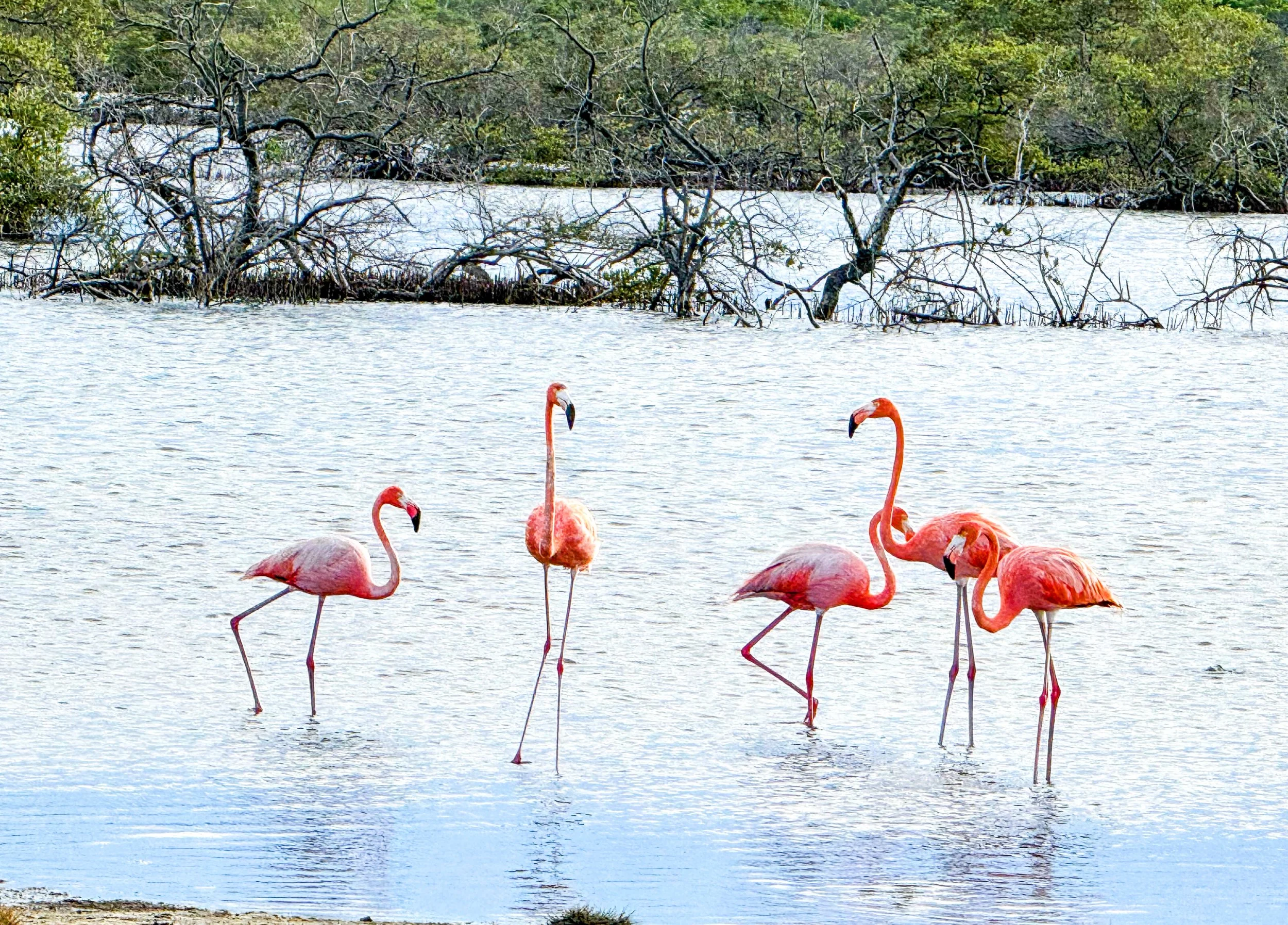
Since 2011, the Bonaire Marine Park has been recognized for its pristine reefs and biodiversity, supporting species like migratory birds and flamingos. It was the first healthy Caribbean marine site nominated, offering hope amid the endangered Belize Barrier Reef. Bonaire's biodiversity was celebrated at a UNESCO workshop for its "outstanding universal value," making it a model for protected areas. While facing challenges like underfunding, Bonaire stands out. Though not yet a UNESCO World Heritage site, it's on the tentative list, highlighting its importance.
In my research for the See-the-Sea website, I reported on Bonaire’s resilience and its importance as a model MPA. I knew Bonaire faced a crisis from the Stony Coral Tissue Loss Disease but didn’t realize how widespread the damage was. We saw this firsthand during our checkout dive at Buddy Dive Resort’s house reef, chosen for its accessibility and my interest in the Staghorn Horn restoration project.
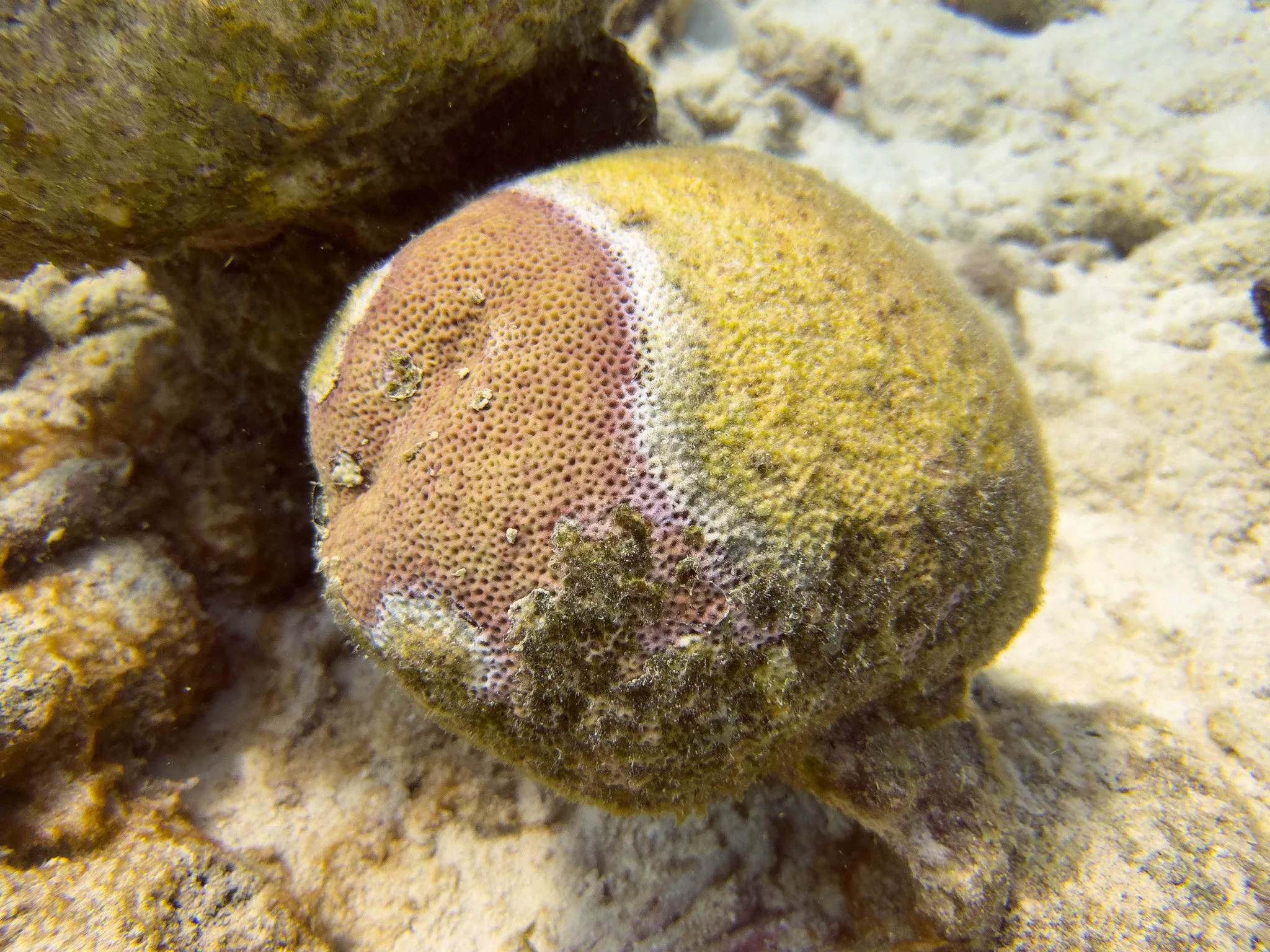
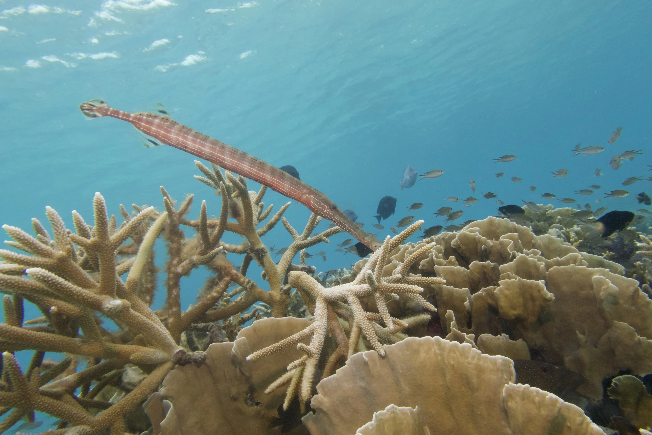
The extent of the damage to the reef became clear as we descended along the fringe reef system and observed that 70-80% of the boulder and mound corals had died. This primarily affected the brain and star corals. We explored depths ranging from 30 to 80 feet and found a consistent pattern of destruction.
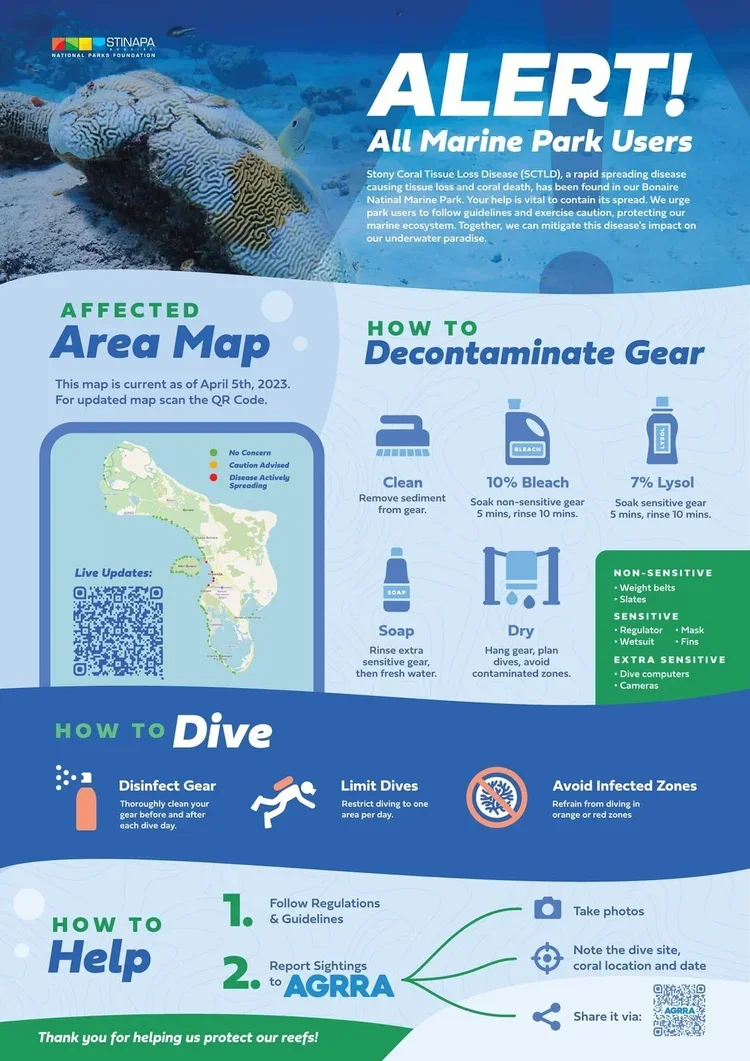
In 2023, STINAPA, Bonaire’s Natural Parks Foundation, issued alerts, including a map tracking the spread of SCTLD, urging divers to decontaminate their equipment after each dive, report the disease's spread to the Atlantic and Gulf Reef Assessment site, and avoid infected areas. The disease rapidly spread through Bonaire’s west-side dive sites.
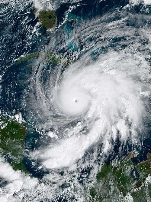
Just twenty-four days later, on October 28, 2025, the strongest hurricane ever to hit Jamaica made landfall on the southwest end of the island. Hurricane Melissa was a Category 5 storm with winds of 185 mph and an incredible low pressure of 892 mb. Originating from a tropical wave seen on October 16 off the West Africa coast. It crossed the Atlantic, became Tropical Storm Melissa on October 21, then remained scattered and wandered due to weak steering and wind shear. It gradually intensified into a Category 5 from October 25-27, peaking at Category 5 strength near New Hope, Jamaica. Melissa was an extremely powerful and erratic cyclone, tying the 1935 Labor Day hurricane as the third-most intense Atlantic hurricane and marking the most intense landfall in the Atlantic basin.
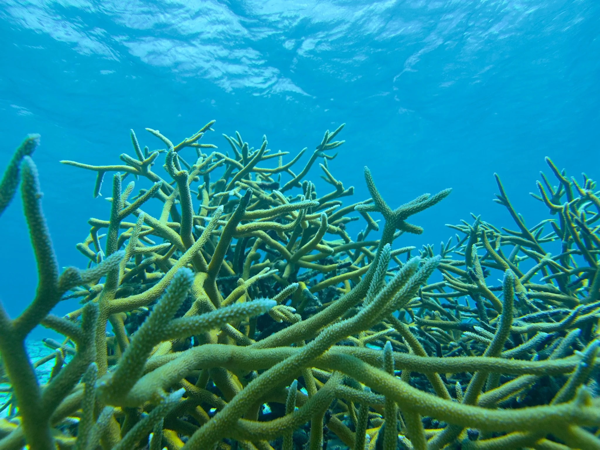
As we dove on the shallow sand flats at 15 to 20 feet, I was amazed at how much the staghorn reef has expanded thanks to the Reef Renewal’s out-planting program. It had easily tripled in size since my last trip in 2022. Additionally, they had added several new coral propagation structures hosting multiple species of stony coral. I also noticed a greater amount of algae growing on everything.
During coral bleaching events, environmental stressors such as high temperature and light damage the photosynthetic machinery of zooxanthellae, causing them to produce an excess of reactive oxygen chemicals like hydrogen peroxide. These tiny 'bombs" can harm the cells of both the algae and the coral host, leading the coral to expel the zooxanthellae from its tissues. This surplus of reactive chemicals can also cause oxidative stress, which damages vital molecules such as proteins, lipids, and DNA within the coral's cells.
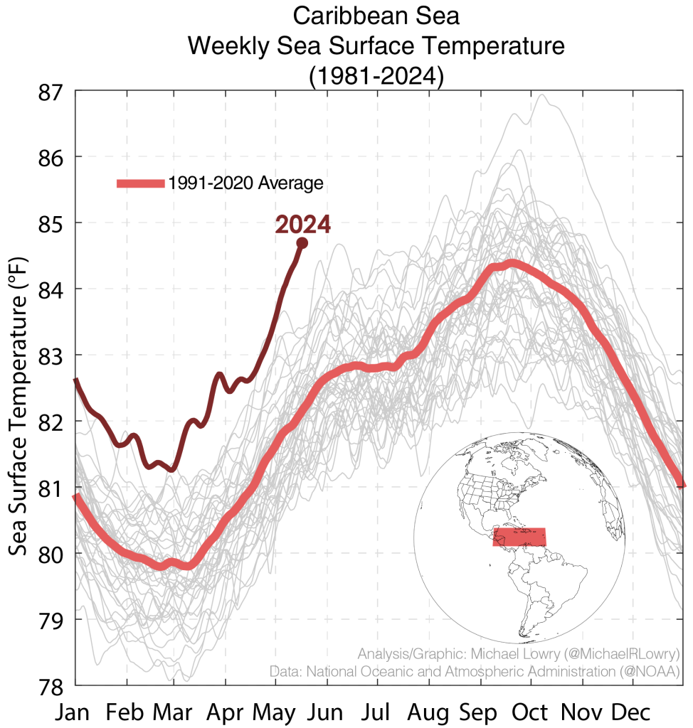
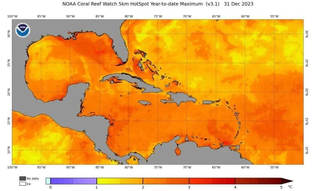
Corals became more vulnerable due to 2023-2024 marine heat waves, with unprecedented ocean warming in the Caribbean causing intense heatwaves and record bleaching. Since March 2023, especially in the Atlantic, this warming caused extensive coral loss. Sea surface temperatures soared early 2023, fueling a prolonged heatwave. By July, temperatures in the Gulf of Mexico and Caribbean were 1-3°C above average, resulting in severe bleaching and widespread death, including colonies previously resilient. By December 2023, the sea surface temperatures surrounding Bonaire was 3.5oC (6.3oF) temperature above normal. This heat wave persisted into 2024.
On September 22, 2024, the same marine heat wave contributed to the formation of Hurricane Helene, which developed as a broad low-pressure system in the western Caribbean Sea and grew into a powerful cyclone causing widespread destruction in the Southeastern US in late September. It was the strongest hurricane to hit Florida's Big Bend, the deadliest Atlantic hurricane since Maria in 2017, and the deadliest in the US since Katrina in 2005. Strengthening due to changing weather conditions, it became a hurricane early on September 25 and rapidly intensified while crossing the Gulf of Mexico, reaching Category 4 on September 26. Helene then made landfall at its peak near Perry, Florida, with winds of 140 mph. The storm caused severe flooding, especially in Western North Carolina, East Tennessee, and southwestern Virginia, and spawned tornadoes. It flooded Tampa Bay, setting storm surge records, resulting in 252 deaths and an estimated $78.7 billion in damages, making it one of the costliest Atlantic hurricanes.
Sylvia Earle's 2009 TED talk discusses her efforts using her 'My Wish' to promote ocean protection and create 'Hope Spots.' She highlights oceans' essential roles—producing oxygen, shaping climate, connecting ecosystems—and urges action to conserve them for future generations. Earle warns that half of the world's coral reefs are damaged or destroyed, and that most could vanish by mid-century if left unprotected. NOAA estimates over 90% of reefs could be at risk by 2030, emphasizing the need for collective conservation effort.
This dive marked the first time Kathy and I saw such extensive coral reef damage. We'd often visit Bonaire to refresh ourselves, viewing it as a sacred place. The reef's fish and animals felt like friends. In three years, it had collapsed, and I cried, mourning the loss.
For us, this was truly paradise lost. However, hope lies in organizations like Reef Renewal of Bonaire. On October 4, 2025, we finished our last dive, and I noticed the water temperature at 60 feet was 89°F. I told Kathy that if a tropical depression entered the Caribbean, it could lead to a major hurricane.